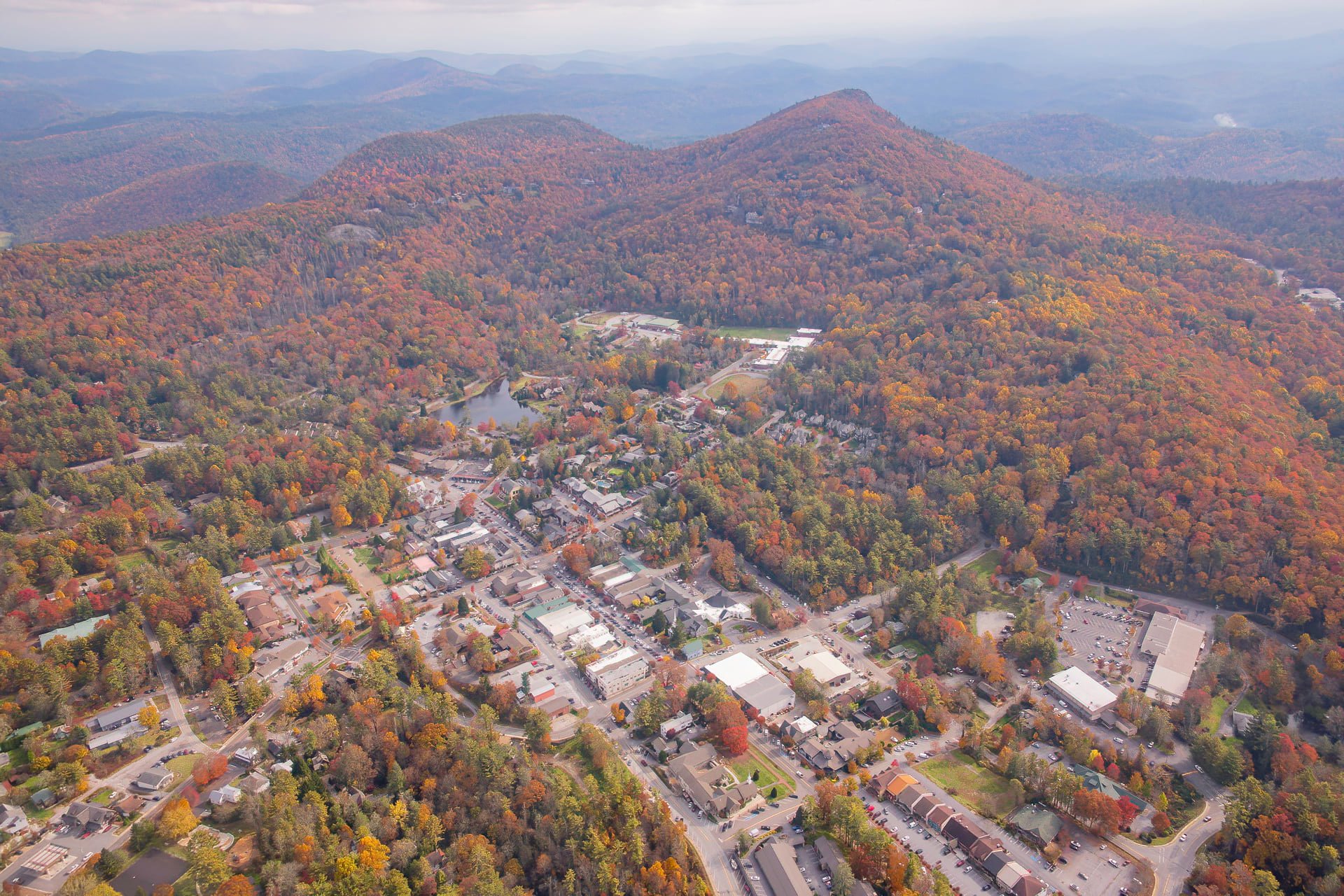
Highlands, North Carolina is a village located on the eastern continental divide at almost 4000 feet of elevation. Over 85 inches of annual rainfall insure beautiful forests, breath-taking waterfalls, and exciting whitewater activities.
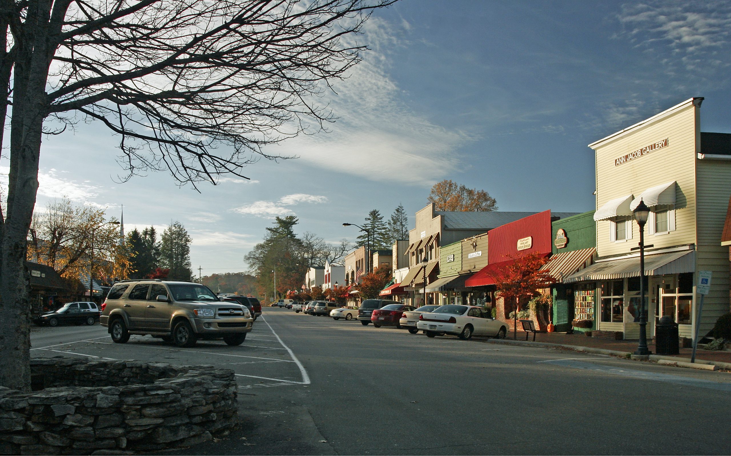
The area’s natural beauty attracts thousands of summer residents to enjoy the area’s fourteen championship golf courses and dozens of unique shops in the village. Steve Ham has found it to be the ideal atmosphere to conduct a technical consulting business. While remotely located, Highlands is only two and a half hours driving time to Atlanta, Charlotte, Knoxville, and the new South Carolina automotive alley.
Here are a few of the reasons to live on the Highlands plateau:
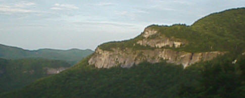
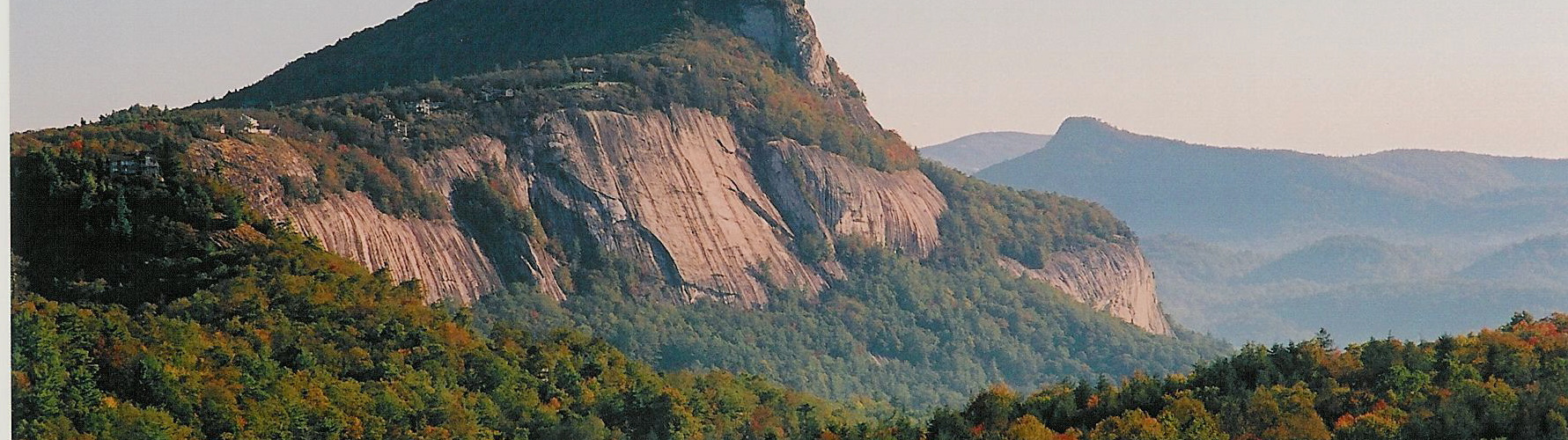
Whiteside Mountain is the landmark of the southern Blue Ridge. At 4,950 feet it is certainly not the highest mountain in the area, but its unique profile of massive granite cliffs dominates the view for a ten mile radius and it is distinguishable from Greenville SC, about 50 miles to the south. During the 50’s and sixties there was a private tour concession known as “Whiteside Mountain- The Face of Creation”. Today it is part of the Nantahala National Forest. Over 50,000 hikers visit Whiteside Mountain’s trails annually. During WWII, civilian spotters were positioned on the mountain to watch for enemy aircraft. No aircraft were ever spotted. Peregrine falcons, nesting on the “Face of Creation”, are easy to spot.
The altitude and rainfall keep Highlands very cool in the summer months. Over half of the surrounding area is part of three major National Forests- Nantahala, Pisgah, and Sumpter. Also in the area is the Great Smokey Mtns. National Park, The Blue Ridge Parkway, and the Cherokee Reservation. Two major river systems are born on the Highlands plateau.
Nearby, Joyce Kilmer National Preserve is in the middle of the wilderness area where Olympic bomber Eric Rudolf successfully hid from hundreds of federal officers for more than five years. While the FBI reward of $1,000,000.00 is no longer offered, the view from Snowbird Ridge is worth a million dollars in itself. The view includes the last remaining grove of Giant Poplars in north America.
Driving the Highlands Plateau
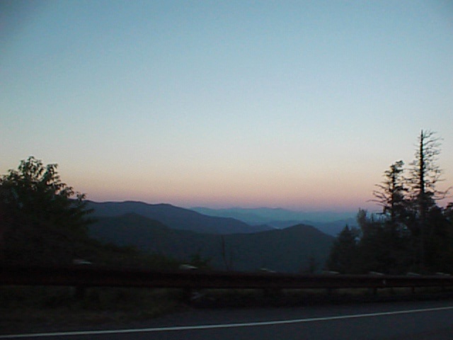
Magic awaits those who love driving! Highlands is surrounded by National Forests with mountains, rivers, forest canopies, wildlife, and unique driving experiences.
When you arrive in town, you’ll find the main intersection. From this stop light in the center of town, each of the four directions is rewarding to the driver and passenger. And each road presents a different personality. Highlands is at the top of the Plateau, so it’ll be a downhill experience when driving away from Highlands and uphill for your return.
Here are four options to explore:
Your first adventure should be “The Waterfall Highway” (US 64 west, or The Franklin Road to locals), which will take you along the Cullasaja River. Being a river road, it snakes along with the river and is nicely banked and freshly paved with moderately tight turns and many short straightaways but no passing zones. High speed motoring is not recommended on this segment. Curves and inclines keep the driver engaged even at reduced speed. Passengers will be dazzled by the scenery of the river and mountain peaks.
The first waterfall encountered will be Bridal Veil Falls. There is a parking area on the side of the road, where visitors can park and view the falls.
About a mile further down the road is Dry Falls and its large parking area with facilities. On foot, you can walk down to the falls where the path continues behind this large waterfall. While the name implies otherwise, you might want an umbrella or raincoat if you truly want to stay dry.
Continuing toward Franklin will take you past Cliffside Lake, a great picnic site. Traveling along the Cullasaja River for a few more miles brings you to Bust Your Butt Falls, a popular swimming spot with plenty of parking.
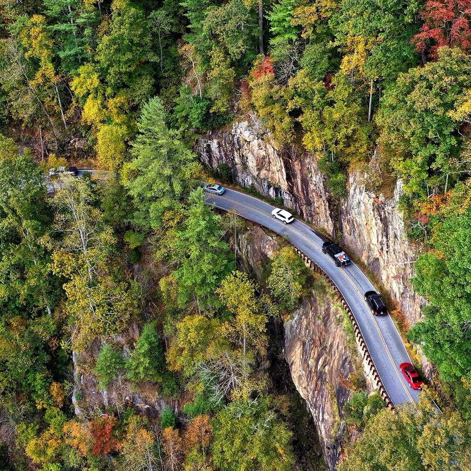
The final attraction will be Cullasaja Gorge and Falls. Here, the mere existence of a road is a marvel with its sheer cliff face on one side and massive gorge on the other; the driver must stay focused on the road. Passengers can view the impressive waterfall at the bottom of the gorge.
About a mile past the gorge is Buck Creek Road where you can turn around and drive back to Highlands; this road should be driven in both directions. Alternatively take Buck Creek Road, which will intersect with US 64 east of Highlands.
Going north from the main intersection, US 64 East is The Cashiers Road and it offers great mountain views and varying terrain. Nicely banked switchbacks, varying elevation, and medium straightaways make this the “driver’s road” in the area. Driving across ridges and through valleys you will pass five golf courses as you approach Whiteside Mountain, Highlands’ most popular hiking trail.
Continuing toward Cashiers, the road changes personality, going through a forest canopy with tighter turns and more decline. From the Cashiers Crossroads, an alternative return to Highlands can be taken on NC 107 north to Norton Road, which snakes back to US 64 east of Highlands. For additional exploration and beautiful scenery, continue to travel Hwy 64 East towards Lake Toxaway and the historic Greystone Inn.
The Walhalla Road, NC 28, runs out of town to the south as you depart the High-lands Plateau. There are long distance mountain views as the road drops through valleys and crosses rivers and ridges. This route has fantastic sweeping turns and inclined straightaways, making it the fastest road in the area. In a few miles, the road passes the Georgia state line and the community of Satolah. Continuing on Highway 28 toward Walhalla and into South Carolina, the road levels out and follows the Chattooga River with interesting river views. An alternative re-turn route to Highlands is Warwoman Road, which intersects Highway 28 south of Satolah and runs to Clayton, Georgia.
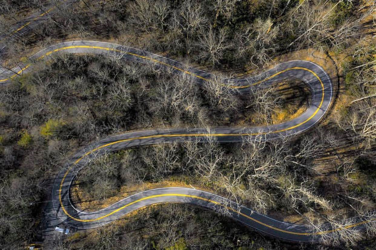
Our final adventure is Highlands best-kept driving secret − Horse Cove Road. From our main intersection in the middle of Highlands, proceed east on Main Street and just keep going. You’ll pass Highlands Nature Center and Sunset Rock Trail, popular designations for visitors. Passing Bowery Road on the left, the real fun begins as you cross the Eastern Continental Divide.
Over the next 1.8 miles of travel the elevation drops 990 feet, making an average 10 percent grade. Forty hairpin turns and switchbacks make an unrivaled driving experience. The turns are perfectly banked and separated by steep short straight sections allowing the driver to set up a driving rhythm. Near the bottom of the valley is Rich Gap Road, a good turn-around spot and the location of Highlands’ largest tree, the Bob Padgett Poplar. The uphill return to Highlands is even more rewarding. The driver can use power on uphill straights and gravity to supplement braking into the corners.
We hope you enjoy the roads of Highlands. Enthusiasts will be stimulated into spirited driving, but we ask that you be safe and courteous as you explore the many wonders of the Highlands Plateau.
For more information about Highlands NC, visit their website:
http://www.highlandschamber.org